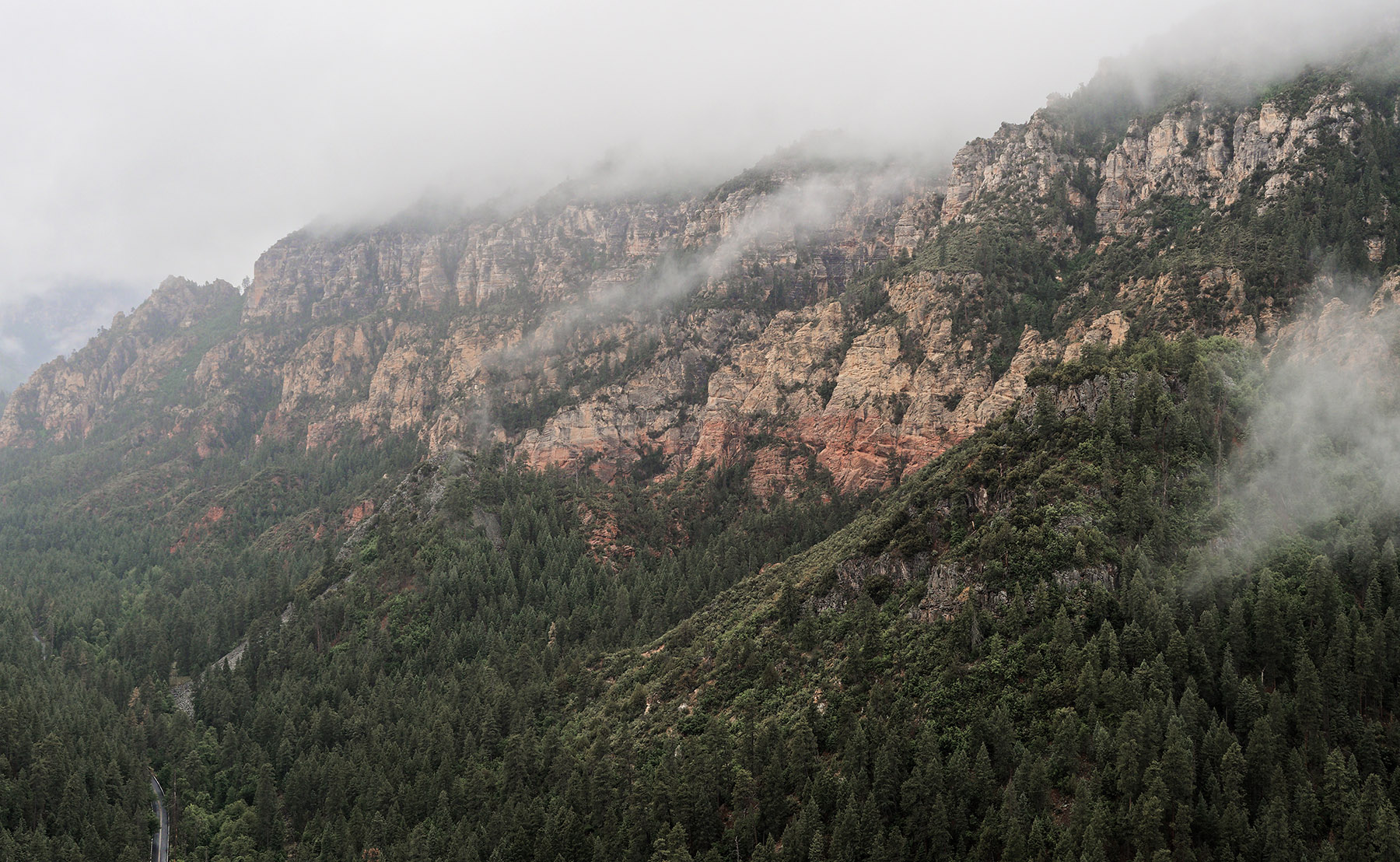
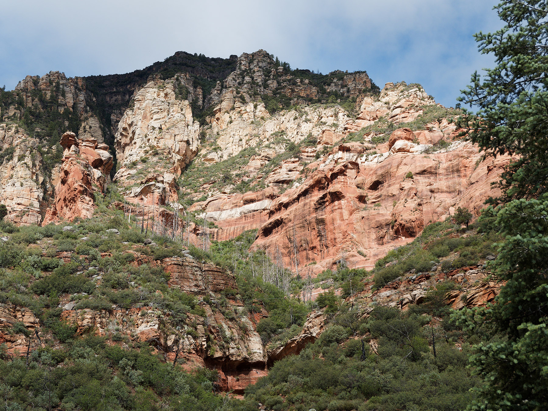
West wall of the canyon at Oak Creek Vista. The Kaibab formation is mostly cloud covered. Toroweap Formation and Coconino Sandstone are lighter colored and separated by a thin band of trees. The darker upper part of the Schnebly Hill Formation is visible.
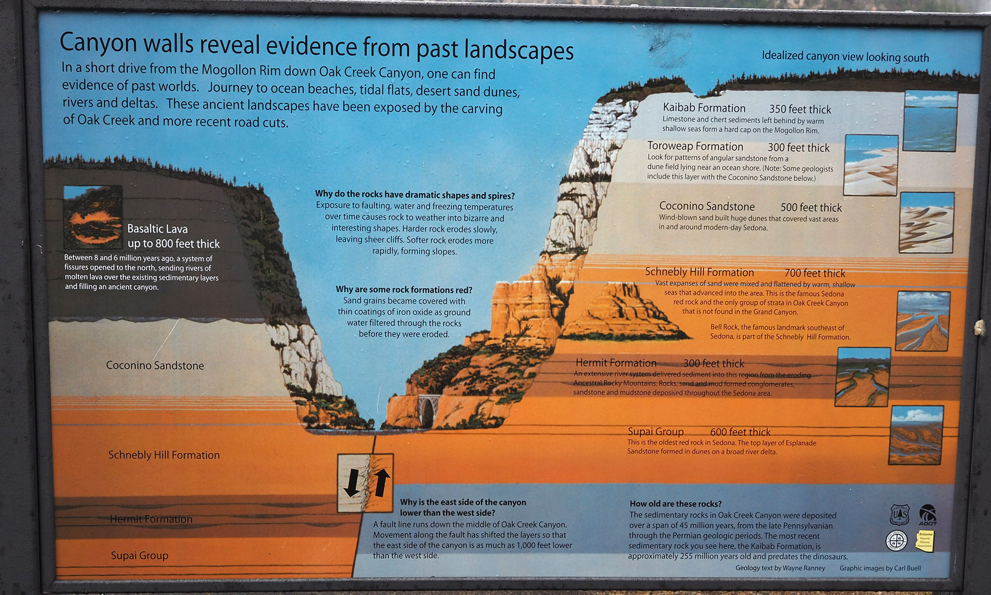
Schematic of Oak Creek Canyon geology from the US Forestry Service at Oak Creek Vista along State AZ 89A.
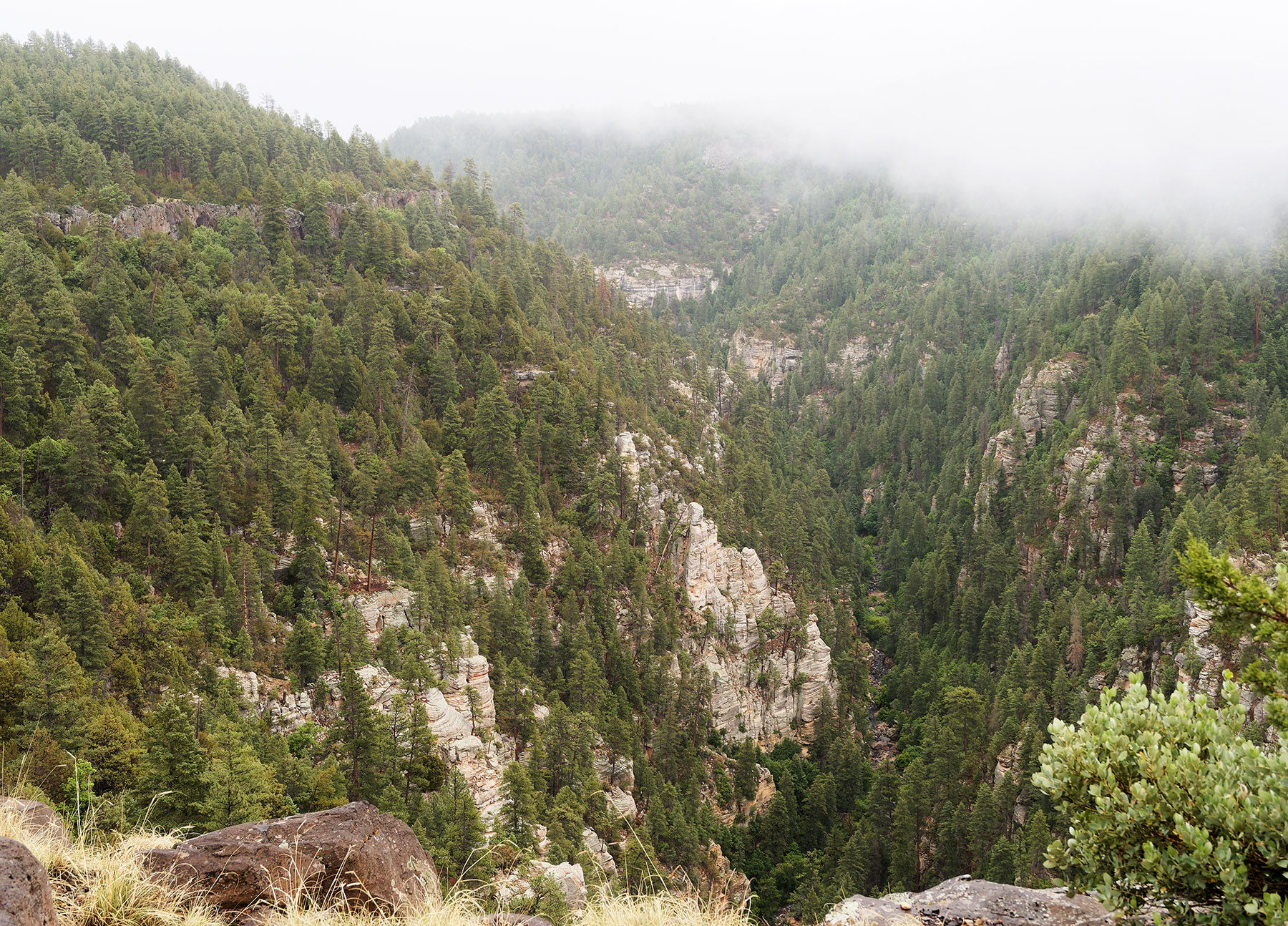
East wall of Oak Creek Canyon. In the bottom of the field is Coconino Sandstone. Upper sedimentary layers seen in the West wall are not present, presumably due to erosion. A dark layer of basalt is visible through the tree and represents lava flows that occurred 8 and 6 Ma.
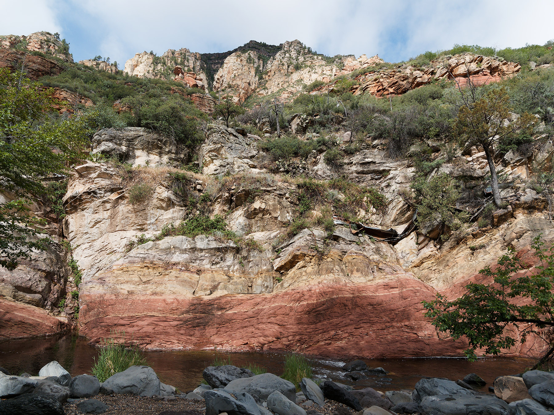
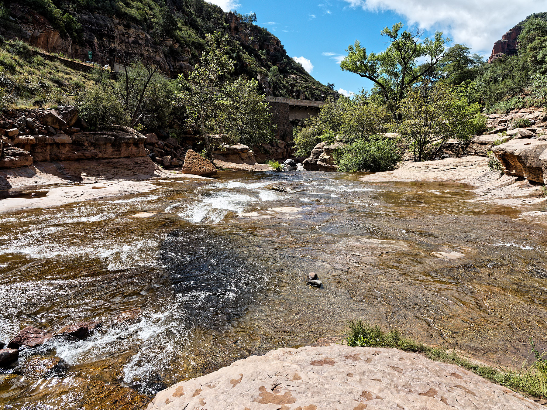
Oak Creek at the bottom of Oak Creek Canyon below the Halfway Picnic location on AZ 89A. Tilted layers of Supai sandston are at the water level. Light Coconino sandstone is visible at the top of the field.
At the bottom of Oak Creek Canyon below the Halfway Picnic location, Darker Schnebly Hill Formation and Hermit formation are visible below Coconino Sandstone.
Oak Creek runs through Supai Group sandstone at Slide Rock State Park.